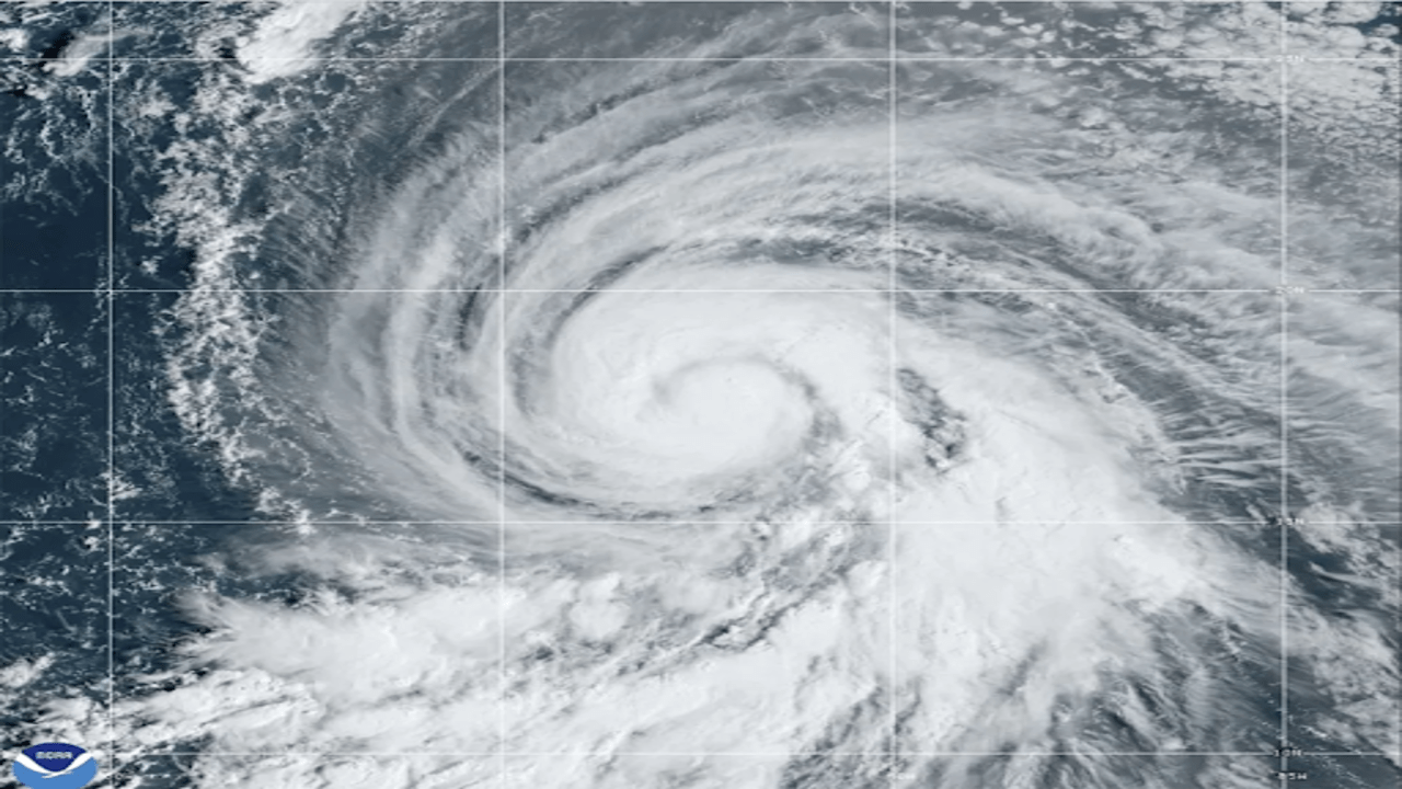
A satellite image from NOAA, taken on Wednesday, October 2, 2024, shows Hurricane Kirk in the Atlantic Ocean. (Image via NOAA)
Hurricane Kirk intensified into a powerful Category 4 storm on Thursday, with forecasters warning that it could bring dangerous waves and rip currents along the U.S. East Coast, as well as in Bermuda, the Greater Antilles, and the Bahamas. This potentially life-threatening surf is expected to start impacting coastal areas over the weekend, prompting warnings for those living near or visiting the affected regions to remain cautious.
As of Thursday, Kirk was swirling in the central Atlantic Ocean, with the possibility of becoming even stronger within the next day. However, despite its strength, Kirk is currently still waiting to make landfall. According to the U.S. National Hurricane Center, the hurricane is forecasted to stay out to sea, moving away from populated areas.
The storm, with maximum sustained winds reaching 130 mph (215 kph), is currently located about 1,085 miles (1,745 kilometres) east-northeast of the Northern Leeward Islands. These strong winds are accompanied by powerful ocean swells, which are expected to reach parts of the Leeward Islands by Friday, before extending to Bermuda and the Greater Antilles on Saturday. By Sunday, the U.S. East Coast and the Bahamas are predicted to feel the effects of the storm’s waves. The National Hurricane Center urges people in these areas to be aware of the potential for dangerous surf conditions and rip currents that could endanger swimmers and beachgoers.
Despite the size and strength of Kirk, there are currently no coastal watches or warnings in effect, as the hurricane is expected to remain over open waters. Residents along the coast, however, are advised to stay informed about any updates regarding the storm, especially as the weekend approaches and ocean conditions worsen.
In the midst of Hurricane Kirk's progress, another tropical system is also stirring in the Atlantic. Tropical Storm Leslie formed late Wednesday in the eastern part of the ocean, and forecasters predict that it could strengthen into a hurricane by Friday. Like Kirk, Leslie currently poses no direct threat to land, but meteorologists are keeping a close watch on its path and development.
At the moment, Leslie is located around 580 miles (930 kilometres) west-southwest of the southernmost tip of the Cabo Verde Islands, with maximum sustained winds of 50 mph (85 kph). As it moves further westward, the storm could intensify, although it remains far from any landmass.
While these two storms churn through the Atlantic, the Southeast region of the United States is still grappling with the aftermath of Hurricane Helene, which struck last week. The destructive hurricane left behind a swath of devastation, leading to tragic loss of life and widespread damage. Rescue teams continue their efforts to find people who are still unaccounted for in the wake of the storm.


