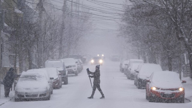
A person walks across a snowy street in Halifax on Wednesday, January 29, 2025, carrying a snow brush as strong winds and heavy snowfall cover the city. Environment Canada is urging people in the Maritimes to get ready for rough weather expected to hit the region tomorrow. The Canadian Press
A massive winter storm is making its way to Eastern Canada, through Ontario and Quebec, bringing heavy snowfall, freezing rain, and strong winds. The storm is expected to reach Atlantic Canada by Friday, impacting multiple provinces with severe weather conditions.
Meteorologist Ian Hubbard explained that nearly the entire eastern half of Canada would experience the storm in some way. The low-pressure system began moving over Toronto on Wednesday afternoon, heading toward Montreal and Quebec City overnight. By Thursday, it will reach New Brunswick, Nova Scotia, and Newfoundland, bringing significant snowfall and ice.
Many areas in Ontario and Quebec are under snowfall warnings. Ontario’s snowfall advisory stretches from the Temiskaming-Temagami area in the north to Sarnia in the south. The Toronto region is expected to receive up to 15 cm of snow by Thursday morning, while more northern areas, including Ottawa and cottage country, could see as much as 40 cm.
Southern Quebec, including Montreal and Quebec City, is also in the storm’s path, with snowfall projections ranging from 15 cm to 40 cm. "Quebec is right in that sweet spot," Hubbard noted, suggesting some areas may experience the heaviest accumulation.
In New Brunswick, the central and northern parts of the province could see up to 25 cm of snow, with snowfall rates reaching 4 cm per hour. Nova Scotia residents are being warned of potential power outages and hazardous roads as the storm brings a mix of snow, ice pellets, and freezing rain on Thursday afternoon. In the southern part of the province, the precipitation is expected to turn into rain later in the day.
Prince Edward Island will also be affected, with western parts of the island expecting 15 to 20 cm of snow. Ice pellets and freezing rain will coat central and eastern areas Thursday evening.
Newfoundland will experience blowing snow on Friday morning, with up to 25 cm forecasted in western areas. The eastern parts of the island are likely to see slightly less snowfall.
The storm isn’t the only weather threat this week. Extreme cold warnings are in effect for southeastern British Columbia, much of the Prairies, and northwestern Ontario. Wind chill values in these areas have dropped to between -35°C and -40°C, with even colder temperatures expected by Friday.
Western Labrador is facing dangerous wind chills that could reach -50°C overnight into Thursday morning. Environment Canada is urging residents to cover up, warning that frostbite can develop in minutes in such extreme conditions. Officials also remind pet owners to bring their animals inside, as it’s unsafe for them to be exposed to such cold temperatures.
In northern Labrador, a wind warning has been issued for the town of Nain, where gusts up to 100 km/h could cause property damage.
As the storm progresses, authorities are advising residents in affected areas to stay updated on weather alerts, avoid unnecessary travel, and prepare for possible power outages.