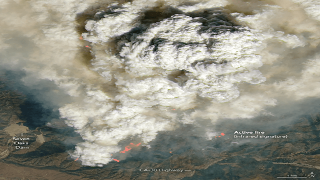
Satellite images from September 9, 2024, show the Line Fire’s dramatic pyrocumulus clouds. The pictures reveal pink and orange areas indicating where the fire is most active. NASA
California’s Line Fire is so fierce that it’s creating its own weather patterns. On September 9, 2024, the intensity of the fire caused dramatic “fire clouds,” known as pyrocumulus, to form. These clouds appeared just as a high-resolution weather satellite, hundreds of miles above Earth, was capturing images of the scene.
Pyrocumulus clouds are a result of extreme heat, such as that from intense wildfires or volcanic eruptions. When the heat rises rapidly, it cools and condenses the moisture in the air, forming these clouds. Unlike ordinary clouds, pyrocumulus clouds are dark and heavy because they contain large amounts of smoke and ash from the fires.
On that particular day, the Landsat-8 satellite, a collaboration between NASA and the U.S. Geological Survey, captured stunning images of the Line Fire’s pyrocumulus clouds. The clouds, which appeared on the satellite images as dark, cauliflower-like formations, contrasted sharply with the fluffy, white clouds seen in other areas.
On September 9, 2024, the Line Fire in Southern California created pyrocumulus clouds, as seen in NASA's imagery. NASA
The satellite images showed the Line Fire’s pyrocumulus clouds as they were surrounded by a brownish smoke haze. By the afternoon, these clouds evolved into pyrocumulonimbus clouds, which are capable of producing lightning and rain. While the rain could aid in firefighting efforts, it also brings risks. The accompanying gusty winds and additional lightning could potentially spark new fires in the already dry areas.
The development of pyrocumulonimbus clouds highlights the extreme nature of the Line Fire and its capacity to influence weather patterns. As these clouds rose and morphed, they contributed to a complex and dangerous situation, illustrating the powerful interaction between wildfires and atmospheric conditions.


