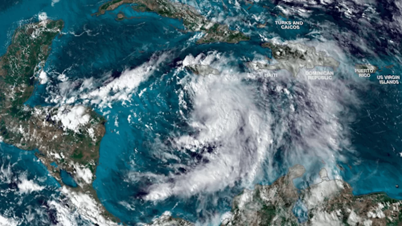
Tropical Storm Rafael developed in the Caribbean Sea on Monday afternoon. CNN
Tropical Storm Rafael formed over the Caribbean Sea on Monday afternoon, potentially bringing a rare November storm to the United States this weekend. The storm is expected to strengthen into a hurricane by Tuesday, gaining power as it moves over the warm waters of the northwest Caribbean. It will then strike Cuba on Wednesday before entering the Gulf of Mexico. The storm's path and impact on the U.S. Gulf Coast remain uncertain due to the storm’s recent formation and ongoing developments.
Although it’s still too early to predict where Rafael will land or how intense it will become, the National Hurricane Center warned that it remains difficult to forecast. They emphasized that the storm's exact trajectory will continue to evolve, and the public should remain alert. A tropical storm warning was issued for the Florida Keys on Monday afternoon, adding to existing warnings for Cuba, Jamaica, and the Cayman Islands.
Initial forecasts suggest that Rafael’s center could reach the Gulf Coast later this weekend, possibly affecting areas from the Florida-Alabama border to Louisiana. However, these predictions could change as the storm continues its journey through the Caribbean. The uncertainty is highlighted by two major models showing very different scenarios. One model suggests the storm will track toward the northwest after hitting Cuba, possibly making landfall between Louisiana and Florida. Another model proposes a turn to the west once it reaches the Gulf, which could lead the storm to weaken or make landfall in northeastern Mexico.
The storm's development could bring a significant rainfall threat, especially for Florida and the southeastern U.S. regions. Heavy rains are already affecting the Caribbean, with potential for flooding, especially in Cuba and Jamaica, where 3 to 6 inches of rain are expected. The storm could also bring a risk of mudslides, particularly in the mountainous areas of Jamaica and Cuba.
The storm's impact in the Caribbean is already being felt. In Jamaica, strong winds and rain are affecting many areas, and the government has canceled in-person classes for schools. Meanwhile, parts of Cuba and the Florida Keys are bracing for tropical storm-force winds, with hurricane-force winds expected to reach the Cayman Islands by Tuesday afternoon and western Cuba by Wednesday.
In addition to heavy rain and winds, Rafael is expected to bring a significant storm surge. Parts of the Cayman Islands could experience up to 3 feet of surge, while western Cuba could see dangerous surges up to 9 feet. In the Florida Keys, surge levels could reach up to a foot above the high tide, with the possibility of tornadoes as well.
Despite tropical activity usually winding down by November, storms in the month are not uncommon. However, U.S. landfalls in November are rare, as most storms typically hit before the end of October. Experts note that, although there have been five hurricanes on the Gulf Coast this year, Rafael is not expected to be as severe as previous storms like Hurricanes Helene and Milton, given the potentially disruptive effects of Cuba’s terrain and the winds over the Gulf.
As the storm continues to develop, authorities are urging residents from the Gulf Coast to northeastern Mexico to monitor updates closely, as the situation remains fluid.


