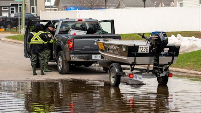
Strong thunderstorms moved across Alberta on Monday evening, bringing heavy rain, strong winds, and hail to several areas. The Weather Network
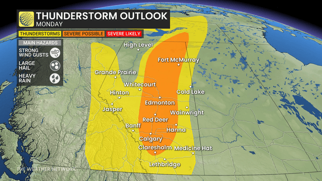
Western Canada is heating up, and Alberta is feeling it the most. Warm, summer-like conditions are making a return, but they’re also bringing trouble. On Monday, Alberta saw the perfect setup for strong storms to form. By afternoon and evening, things started turning dangerous.
Thunderstorm Warnings Begin
The first warnings came out late Monday afternoon. Storms developed west of the QE2 Highway, just south of Edmonton, and also popped up north of Lethbridge. These storms quickly became severe, with strong winds, pounding rain, and large hail.
People in affected areas were urged to stay alert. Conditions changed quickly, and weather warnings were updated throughout the evening. Officials reminded everyone to take the threats seriously.
Cold Front Sparks Intense Weather
A cold front stretching across Alberta triggered these storms. When warm air clashed with this front, the skies responded. That front, combined with support from upper-level winds, created the perfect storm environment. Central Alberta, especially between Edmonton and Calgary, became the key area for development.
Dangerous Conditions Confirmed
Forecasters warned that some of these storms could be especially powerful. Wind gusts may have reached up to 100 km/h. In some areas, hail as big as a loonie pelted down. Heavy downpours added to the risk, creating difficult conditions for drivers and anyone caught outside.
The strongest activity was expected between 4 p.m. and 8 p.m. local time. During this time, storm clouds thickened and lightning lit up the skies. The region saw a fast-moving line of storms roll through.
Rain Follows Storms
After the worst of the storm passed, steady rain followed. Central Alberta saw the most of it, but parts of eastern British Columbia also received showers. These showers helped cool things down a bit, but not for long.
More Heat Coming Soon
Looking ahead, forecasters expect above-normal temperatures for the rest of May and into early June. A few extremely hot days may be on the way. While no major storm systems are on the radar, more isolated showers and storms could pop up.
Even though storms are possible, the overall weather pattern looks drier than usual. People should stay ready for quick changes, especially with heat and dryness combining.
Stay Safe and Informed
With more warm weather coming, Alberta residents should remain alert. Storms can form quickly in this kind of setup. Listen to local alerts and be ready to take shelter if needed. It’s always better to be safe than sorry.