Toronto faces strong storms and high heat at the same time. CBC
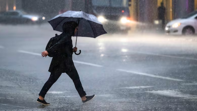
Toronto faced strong storms today with slow-moving showers and heavy rain. Officials said the downpour may continue into the afternoon. Forecasters expect up to 50 mm of rain in certain areas.
The storms could also bring hail the size of nickels and very strong wind gusts. These winds may damage trees, break windows, or even flip over vehicles.
Authorities warned that lightning is also a serious threat during these storms. They reminded everyone, “When thunder roars, go indoors!”
Flash Flooding a Big Risk
The slow pace of the storm means water may pile up quickly in streets and low-lying areas. That raises the risk of flash flooding and poor visibility on the roads.
Emergency Management Ontario asked people to stay alert. If severe weather gets close, they recommend finding shelter right away. They also warned drivers not to attempt driving through any flooded roads.
Dangerous Road Conditions Downtown
Around 10:30 a.m., Toronto police issued a traffic alert. Water began to collect on the Don Valley Parkway near the Gardiner Expressway.
Police urged drivers to avoid the area or choose other routes. Lane restrictions were put in place to help manage the situation safely.
This was the second weather-related warning for the city on the same day.
Heat Warning Still in Effect
On top of the stormy weather, Toronto continues to deal with a heat warning. This is the city’s third heat alert since the end of June.
Today’s temperatures range between 29°C and 32°C. But with humidity, it feels much hotter — close to 40°C.
Officials say Tuesday will likely be the hottest day this week. Relief from the high heat isn’t expected until later in the week.
People are advised to drink water often, stay in cool places, and check on older adults and children. Staying indoors during the hottest hours of the day is also recommended.