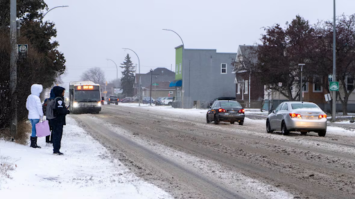
People waited for a bus in Thunder Bay on Wednesday morning as the snow began to fall. The region faces a winter storm warning with up to 20 centimetres expected. CBC
A powerful winter system moves toward Ontario, Quebec, and parts of the Maritimes this week. Forecasters warn that some areas could see between 10 and 60 centimetres of snow. Many residents may need shovels, warm gear, and extra travel time as conditions worsen.
Northern Ontario faces the most severe impact. Environment and Climate Change Canada issued a winter storm warning beginning Wednesday. Some communities could see up to 60 centimetres by the time the system passes.
Storm Creates Travel Problems
“Already snow is falling from many parts and some routes are already closed,” meteorologist Gerald Cheng said during a briefing. Heavy, wet snow and low visibility forced closures of rural schools in the Thunder Bay region. Several buses were also cancelled for safety.
The Ontario Provincial Police reported many highway closures throughout the region. Officers urged people to avoid travel unless absolutely necessary. Affected routes included Highway 144 near Timmins and sections of Highway 11 near Hearst. Part of Highway 631 between White River and north of Hornepayne also shut down.
Peak snowfall may reach four centimetres per hour. Forecasters warn drivers that blowing snow may create near-zero visibility. Strong northerly winds could reach 70 km/h. Officials stress that road closures may continue as conditions worsen.
Storm Expands Into Quebec
The winter storm warning stretches from Lake la Croix across the northern side of Lake Superior, then north to Moosonee and James Bay. It continues east into Quebec, though the alert shifts to a special weather statement in some areas. Regions such as Manic, Baie-Trinité, Sept-Îles-Port-Cartier and Labrieville could receive up to 15 centimetres of snow from Wednesday night into Thursday.
During the same briefing, Cheng outlined a new colour-coded alert system designed to help Canadians understand weather risks more clearly. The system includes three levels:
Yellow for moderate, short-term impacts.
Orange for major, widespread impacts that may last several days.
Red for extensive, long-lasting events that pose serious risk.
Cheng said the alert banners on the weather website and app will match these colours. Red alerts will also trigger mobile notifications.
Strong Winds Hit Southern Ontario
Southern Ontario prepares for a mix of snow and powerful winds from Windsor to Kingston. Cheng said gusts could reach 90 km/h along Lake Erie and northeastern areas of Lake Ontario. These winds will also create lake-effect snow in several counties, including Huron, Grey, Bruce, Simcoe, Wellington and Waterloo.
A snow squall watch is in effect from Wednesday night into Friday. Some locations near Lake Huron may see 30 to 50 centimetres by week’s end. Forecasters warn that squalls may shift through Thursday before settling in place Thursday night.
A special weather statement covers all of southern Ontario, including Toronto. The alert warns of gusts strong enough to toss loose objects, push high-profile vehicles, and cause power outages. Norfolk, Haldimand and the Niagara region face a wind warning starting Wednesday afternoon. Winds could ease slightly Thursday morning but remain strong. Another wind warning is in place for areas near Lake on the Mountain on Lake Ontario’s north shore.
Officials Urge Caution
Meteorologist Steven Flisfeder encouraged people to check road conditions before travelling. He advised drivers to keep safe distances, slow down and plan extra time for trips. “Travel is likely to be impeded as a result of those visibility issues,” he said. He warned that conditions may remain difficult through Thursday and Friday.