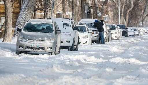
A Winnipeg resident clears snow from their car windshield following an overnight snowfall on Thursday, December 18, 2025. The Canadian Press
Canadians across the country began the new year under a wide range of winter weather warnings as harsh conditions settled in from the West Coast to the Maritimes. Snow squalls, dense fog, freezing drizzle, and extreme cold pushed many regions into full winter mode, creating difficult travel and safety concerns.
According to Environment Canada, yellow weather warnings covered large parts of the country on Friday. The alerts stretched from coastal British Columbia to central Canada and into Quebec, reflecting the varied but challenging weather patterns affecting millions of people.
Dense Fog Reduces Visibility in the West
Western Canada faced major visibility issues as thick fog rolled across parts of British Columbia and Alberta. Areas near Prince Rupert sat under warnings for dense fog, while a long stretch of Alberta, from Edmonton south to the U.S. border, also faced similar conditions.
“Areas of dense fog continue,” the Alberta warning said. “Visibility will intermittently improve, but foggy conditions are generally expected to persist through Saturday. Visibility will be suddenly reduced at times.”
The fog made driving especially dangerous, with sudden drops in visibility catching motorists off guard. Officials urged drivers to slow down, use headlights properly, and allow extra time for travel.
In Alberta, the fog warnings also came with freezing drizzle alerts. Light freezing rain increased the risk of slick roads and icy sidewalks, making even short trips hazardous.
Snow Squalls Hit Ontario Hard
Further east, Ontario dealt with intense bursts of snow caused by lake-effect weather systems. Areas near Sault Ste. Marie and along the shores of Lake Huron in southwestern Ontario remained under snow squall warnings.
Forecasters expected five to 10 centimetres of snow near Sault Ste. Marie by the end of the day, while communities closer to Lake Huron prepared for up to 15 centimetres. Heavy snowfall combined with strong winds created whiteout conditions at times.
“Under the snow squall bands, visibility will be significantly reduced due to the heavy snow combined with blowing snow, and snow will quickly accumulate,” the weather agency warned.
Snow squalls often arrive quickly and hit with little warning, making highways especially dangerous. Emergency officials advised drivers to avoid unnecessary travel during active squalls.
Extreme Cold Settles Over Quebec
Quebec also felt the deep chill of winter, particularly near Quebec City. Warnings highlighted dangerous overnight conditions as temperatures dropped sharply.
Forecasters predicted wind chill values reaching -38 overnight and into Saturday morning. Strong northwesterly winds combined with bitter cold to create dangerous conditions outdoors.
“Cold temperatures combined with northwesterly winds will produce extreme wind chill values over these areas,” the alert said. “Extreme cold puts everyone at risk.”
Officials reminded residents to limit time outside, dress in layers, and watch for signs of frostbite or hypothermia.
Weather Patterns Remain Seasonal
Despite the long list of warnings, meteorologists say the conditions remain within the range of a typical Canadian winter. Anthony Farnell, a chief meteorologist, said the cold snap looks sharp but not unusual.
“It’s currently colder than normal across most of Canada from Alberta to the Maritimes but certainly not record breaking or anything like that,” he said. “Also nothing unusual about the amount of warnings in place.”
Winter warnings often increase during early January as colder air settles in and weather systems move across the country.
Relief Expected Next Week
There is good news on the horizon. Forecasters expect a noticeable shift in weather patterns next week, bringing milder air to much of the country.
“The big story is that this cold and wintery weather is going to take a break next week as the pattern changes,” Farnell said.
He added that Ontario, Quebec, and the Maritimes could see temperatures rise above freezing for several days. That shift may bring rain and snowmelt in some regions, creating what he described as a “big January thaw.”
While warmer air may ease extreme cold, officials caution that melting snow and rain can bring their own challenges, including slushy roads and localized flooding.
Staying Safe Through Changing Conditions
With weather shifting quickly, officials encourage Canadians to stay informed and prepared. Checking local forecasts, adjusting travel plans, and dressing for conditions remain key steps during winter weather events.
As the country moves through the heart of winter, these early January warnings serve as a reminder of how quickly conditions can change—and how important it is to stay alert.