Weather officials say drivers in Huron and Middlesex counties, along with eastern Lambton County, can expect extremely poor visibility through the night and into Saturday. Environment Canada warns that blowing snow and strong winds will make it very difficult to see, especially during overnight hours. CBC
A powerful winter storm set its sights on southwestern Ontario, bringing heavy snow, fierce winds, and bitter cold as the weekend began. Environment Canada warned residents to prepare for dangerous conditions, issuing alerts for both blizzard conditions and extreme cold across the region.
An orange blizzard warning covered London, Huron County, Middlesex County, and eastern Lambton County. At the same time, a yellow extreme cold warning stretched across all of southwestern Ontario. Weather officials urged people to stay off the roads unless travel became necessary.
Snowfall and Whiteout Conditions
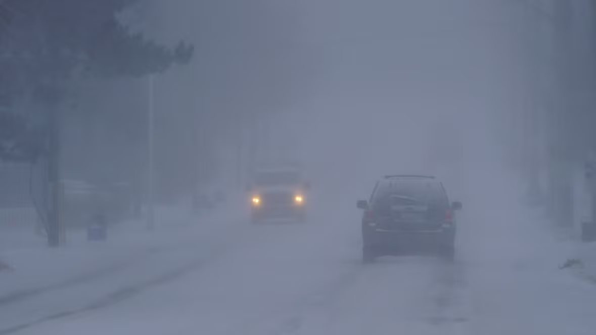
Snow started falling Friday afternoon and continued into the night. Forecasters expected totals between 15 and 20 centimetres by Saturday morning. Strong winds, reaching up to 80 kilometres per hour, created blowing snow and near-zero visibility in many areas.
"For those exposed areas, particularly near the Lake Huron shore, visibility is going to be atrocious," said Trudy Kidd, a meteorologist with Environment Canada. "Travel will be very dangerous. It's best to avoid it, if possible."
Kidd explained that a low-pressure system moved into the region, pulling cold Arctic air south. Northwest winds swept across Lake Huron and produced intense lake-effect snow squalls that added to the storm’s strength.
Extreme Cold Settles In
Temperatures dropped sharply Friday night as the storm intensified. Wind chill values fell between -30 C and -35 C, creating life-threatening conditions for anyone outdoors. Kidd said the cold air would linger through the weekend.
Daytime temperatures on Saturday hovered near -13 C, while nighttime lows dipped to around -18 C. The combination of wind and cold raised the risk of frostbite, which could develop within minutes on exposed skin.
Road Closures and Crashes
Police closed several roads Friday evening because of poor visibility and worsening road conditions. Closures included Highway 23 between Mitchell and Palmerston, Highway 21 from Amberley to Port Elgin, Bruce Road 3 from Paisley to Port Elgin, Highway 9 from Kincardine to Bruce Road 1, and Ilderton Road between Denfield Road and Hyde Park Road.
Earlier in the day, crashes forced temporary closures on eastbound lanes of Highway 402. A transport truck overturned, and another vehicle slid into a ditch. Ontario Provincial Police later reopened all lanes but continued to urge caution.
"The roadways are snow-covered. They're slick, slippery, and, in certain cases, ice-covered," said OPP Sgt. Ed Sanchuk. "So you need to reduce your speed."
Safety Advice for Residents
Kidd encouraged anyone who must travel to prepare their vehicle. She advised drivers to carry jumper cables and warm winter clothing in case of emergencies. She also urged people spending time outdoors to dress in layers and cover exposed skin to prevent frostbite.
Weather officials expect conditions to slowly improve by the end of the weekend. Light flurries may continue Sunday night, but Kidd said the worst of the storm should pass by then.
"I'm expecting the worst of it will be over by then," she said.