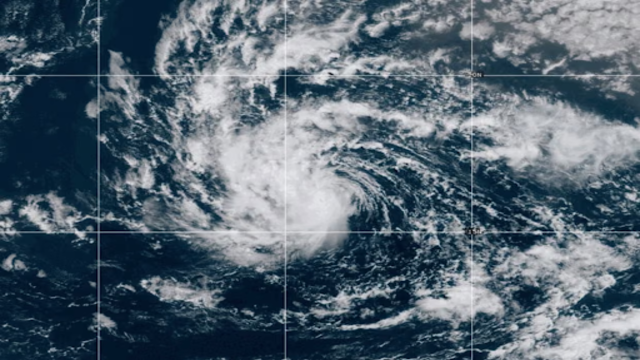
Tropical Storm Erin Strengthens on Wednesday. Credit: NOAA/ AP
A tropical storm picked up speed and became Hurricane Erin by mid-morning Friday as it moved closer to Puerto Rico and the Virgin Islands. The storm is bringing heavy rain, raising concerns about flooding and landslides. Forecasters say Erin will likely grow into a major Atlantic hurricane within the next few days.
By Friday afternoon, Erin was moving west-northwest at about 29 km/h. Winds reached maximum speeds of 121 km/h, making it a category 1 hurricane. Experts expect the storm to intensify further, possibly reaching category 3 strength by Sunday.
Path and Forecast
Erin is the first hurricane of the 2025 Atlantic season and the fifth named storm so far. The system formed last week near the Cabo Verde Islands, where it caused flash floods that killed at least six people. It has since travelled across the Atlantic, gathering energy from warm ocean waters.
Forecasters believe Erin will head toward Florida before eventually turning northeast, keeping it away from the U.S. mainland. However, they warn that its path could shift, leaving some uncertainty about long-term impacts on Bermuda, the Bahamas, or parts of the U.S. East Coast.
Michael Lowry, a hurricane and storm surge expert, explained, “The forecasts for next week still keep the future hurricane safely east of the mainland US.”
Heavy Rain and Dangerous Seas
The National Hurricane Center has issued storm watches for several islands, including Anguilla, Barbuda, St. Martin, St. Barts, Saba, St. Eustatius, and St. Maarten. Antigua, Barbuda, Puerto Rico, and the Virgin Islands are bracing for torrential downpours starting late Friday.
Forecasters say the region could see up to 10 cm of rain, with isolated areas receiving as much as 15 cm. That amount of rainfall increases the risk of flash floods and landslides in mountainous areas. In addition, dangerous swells are expected, creating hazardous conditions for boaters and coastal communities.
AccuWeather predicted that Erin could grow into a powerful category 4 hurricane while moving across warm Atlantic waters. Alex DaSilva, a hurricane expert, said, “Water temperatures at the surface and hundreds of feet deep are several degrees higher than the historical average.”
Impact on North America
Although the storm is not expected to directly strike the U.S. mainland, it will likely create dangerous surf and rip currents along the East Coast. AccuWeather warned that waves could reach as high as 15 feet in North Carolina next week.
If Erin strengthens further, Bermuda may also feel its effects, depending on its eventual path. For now, officials are focused on the Caribbean islands directly in its way, where preparation and warnings are already underway.