Environment Canada ended the snowfall warning for Toronto and nearby communities on Wednesday afternoon after conditions began to improve. CBC
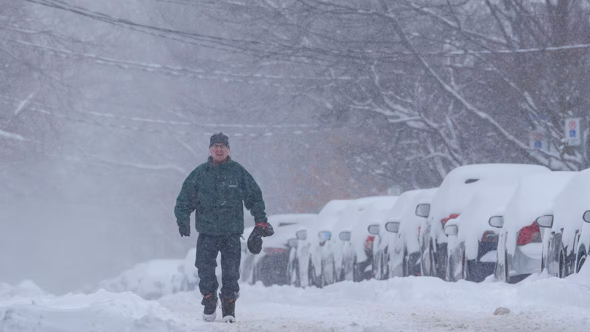
Winter conditions continued to affect the Greater Toronto Area on Wednesday, as snow, icy roads, and bitter cold created difficult travel conditions. Environment Canada lifted the yellow snowfall warning for Toronto, but advisories remained in place for parts of southern Durham Region.
Weather officials said some areas could still receive up to 10 centimeters of snow before conditions improve later in the day. While snowfall was expected to ease by late afternoon or early evening, it still posed risks for the evening commute.
Snowfall uneven across the region
Meteorologists said eastern parts of the GTA would see more snow than western areas. Scarborough, Pickering, Oshawa, and Whitby were likely to receive close to 10 centimeters, while downtown Toronto and western suburbs could see closer to five.
“Lake effect snow is going to continue to play a part in this system,” said Geoff Coulson, a warning preparedness meteorologist. He explained that winds off Lake Huron and Georgian Bay could bring heavier snow to traditional snow belt areas overnight and into Thursday. He also noted that flurries may continue in Toronto on Thursday.
Roads, transit, and city crews respond
Police warned drivers about slippery roads and reduced visibility, especially north of Toronto, where heavier snow began falling earlier in the day. Officers cautioned that blowing snow could make driving dangerous as the system moved through the region.
Public transit also felt the impact. The TTC reported that some buses bypassed problem stops because of road conditions. In Mississauga, city crews spread salt as light flurries continued.
Despite the weather, school boards reported no bus cancellations, and schools remained open.
Bitter cold deepens later this week
Snow arrived as Toronto faced an extended cold snap. Wednesday brought a high near -1°C, but wind chills made it feel closer to -16. Officials said Wednesday would likely be the warmest day of the week.
Temperatures were expected to drop sharply, with lows reaching -22°C on Friday. Daytime highs were forecast to stay near -15°C on Saturday. Weather officials warned that “the coldest air of the season along with freezing wind chills is expected this weekend with the potential for significant snow on Sunday.”
Forecast models showed uncertainty around how much snow could fall on Sunday, but some projections suggested between 10 and 20 centimeters.
Safety warnings near water and ice
Toronto police urged residents to stay away from Lake Ontario and the Toronto Harbour. Officers warned that recent temperature swings, high winds, and waves prevented ice from forming safely.
“While temperatures are now feeling like minus 20 degrees Celsius and colder, any ice that begins to form will be new, unstable ice and is not safe,” police said.
Travel remains a concern
Weather officials said the Alberta clipper moving through southern Ontario would continue to affect roads and walkways. They warned that travel could remain challenging during peak traffic hours, with snow-covered surfaces and poor visibility.
Drivers and pedestrians were urged to use caution as winter conditions persist across the region.