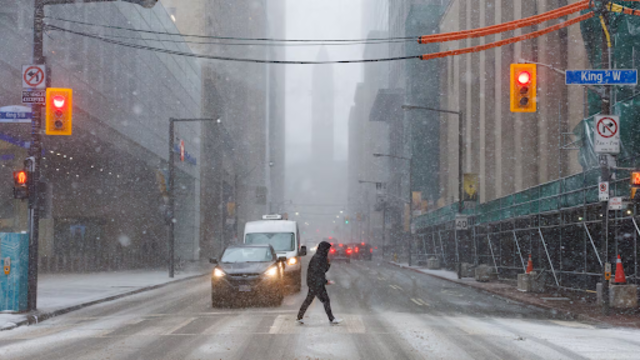
A pedestrian makes their way across a snowy street during a spring storm in downtown Toronto on Wednesday, April 2, 2025. The Canadian Press
Toronto kicked off November with a taste of winter that caught many by surprise. Nearly 10 centimetres of snow fell across the city on Sunday, November 9, setting not one but two long-standing weather records.
According to Environment Canada, the two-day storm brought the highest early-November snowfall since 1981 and the snowiest November 9 in more than five decades.
Meteorologist Geoff Coulson called it “a very rare event for this much snow to fall this early in the Toronto area.”
He explained that while early November snow isn’t unusual, this amount on a single day had never been recorded at Toronto Pearson International Airport, where the city’s official weather data is collected.
Decades-Old Records Broken
The storm dumped 9.8 centimetres of snow on Sunday, with more falling into early Monday morning. The last comparable early-season snowfall occurred on October 21 and 22, 1981, when 6 centimetres fell.
The heaviest snowfall across the region hit Hamilton, which recorded 17 centimetres, while Ottawa saw 12 centimetres.
Before this weekend, the last time Toronto saw snow on November 9 was back in 2018, when just one centimetre was recorded. Coulson noted that the most snow ever seen in Toronto on this date before now was only 1.5 centimetres, back in 1971.
City Responds to Slippery Conditions
The City of Toronto prepared in advance by spreading salt brine on roads, bridges, and steep areas Saturday night to reduce ice buildup. On Sunday morning, road crews began salting and plowing sidewalks as the snow continued to fall.
Despite the city’s efforts, road conditions quickly worsened. The Ontario Provincial Police reported over 200 collisions in the Greater Toronto Area on Sunday due to slippery roads and poor visibility.
Drivers faced tough conditions throughout the day, and officials urged residents to slow down and use caution.
Cold Start to the Week
Although the snow made for a wintry weekend, forecasters say the chill won’t last. Meteorologist Bill Coulter said Monday and Tuesday would remain below seasonal averages before temperatures rise midweek.
“Bursts of snow throughout the day. But Monday’s snow isn’t here to stay,” said Coulter. He added that untreated roads could remain icy overnight as temperatures struggle to climb above freezing.
The city will see gradual warming later in the week. Highs will reach 6°C by Wednesday, climb to 7°C Friday, and dip slightly to 4°C Saturday before returning to 8°C on Sunday, along with light rain and mild winds.
More Snow Ahead?
While this early snowfall might be a one-time event, Coulson said more flurries could come later this month.
“As we go further into November, there’s certainly a possibility of more flurry activity for the GTA,” he said.
For now, Torontonians can only hope that Sunday’s snowy surprise isn’t a sign of a long, harsh winter ahead.