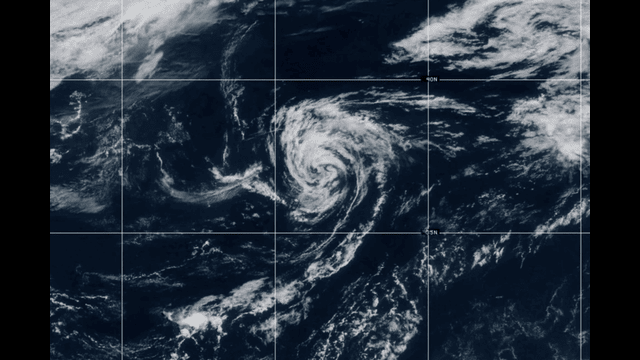
This satellite photo from Tuesday, June 24, 2025, shows Tropical Storm Andrea. AP Photo
Tropical Storm Andrea, the first storm of the Atlantic hurricane season, formed over the ocean on Tuesday but is expected to break up by Wednesday. The National Hurricane Center said Andrea will turn into a post-tropical low by Tuesday night.
At its peak, Andrea had winds of 40 mph (65 kph). It stayed far from land, about 1,110 miles west of the Azores islands, moving northeast at 20 mph (31 kph).
No Danger to People or Land
There are no watches or warnings in place. The hurricane center said Andrea poses no risk to any land areas. It will continue moving northeast through Wednesday before disappearing.
This early storm stayed safely out at sea, giving people on land time to relax without worry.
Busy Hurricane Season Expected
Experts expect this hurricane season to be busy again. Ocean waters are warmer than usual, which can fuel more storms. However, they believe this year will not be as intense as last year’s season, which was one of the most costly ever.
Last year’s storms—Beryl, Helene, and Milton—caused major damage and loss of life. This year, forecasters predict between 13 and 19 named storms in the Atlantic.
Of these, six to 10 could become hurricanes, with three to five reaching strong major hurricane status. These powerful storms have winds over 110 mph (177 kph).
Storms Already Active in the Pacific
While the Atlantic season just started, the Pacific Ocean has already seen several storms. One of them, Hurricane Erick, hit southern Mexico this year.
This shows that tropical storms can form in different oceans at different times.
What to Watch For
Though Andrea is fading, people living in hurricane-prone areas should stay prepared. The season runs from June to November, so more storms could develop.
Officials remind everyone to keep updated with local weather reports and have emergency plans ready.