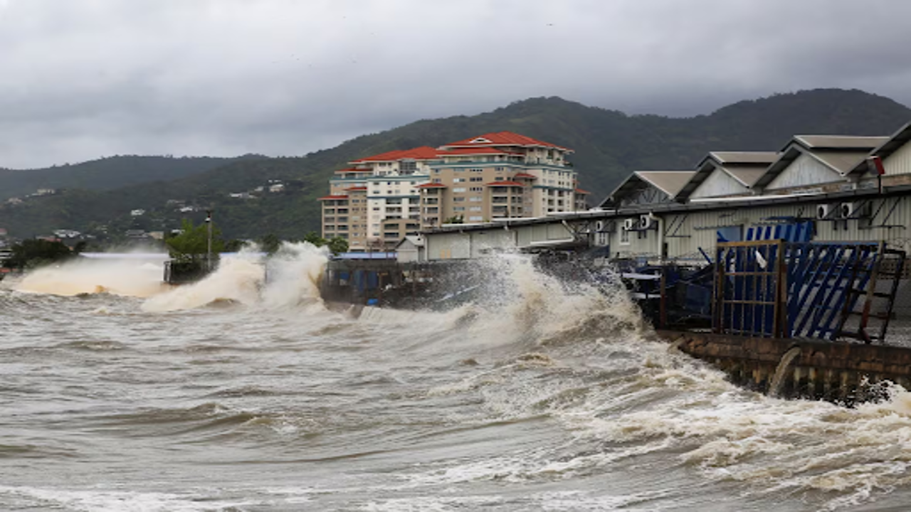
Ocean waves violently hit a coastal barrier following Hurricane Beryl's arrival in Port of Spain, Trinidad and Tobago, on Monday.
Late Monday, Hurricane Beryl intensified to Category 5 strength, wreaking havoc across the southeastern Caribbean with ferocious winds and a devastating storm surge fueled by unusually warm Atlantic waters.
Beryl first struck the island of Carriacou in Grenada as an early-season Category 4 storm, then later strengthened to boast winds of up to 260 kilometers per hour, according to the National Hurricane Center in Miami.
Authorities reported significant damage, including roofs torn off homes and widespread destruction of infrastructure across several islands. Grenada's Prime Minister Dickon Mitchell confirmed one fatality but expressed difficulty in assessing the full extent of casualties due to communication failures in hard-hit areas like Carriacou and Petite Martinique.
From St. Lucia to Grenada, streets were littered with debris — uprooted trees, downed power lines, and displaced items. The storm's impact was particularly visible in agriculture, where banana crops were decimated, and livestock perished in fields.
Residents across the affected region faced harrowing scenes of destruction. Vichelle Clark King, surveying the waterlogged remnants of her shop in Bridgetown, Barbados, described feeling devastated by the storm's aftermath.
As Hurricane Beryl moved west-northwest into the Caribbean Sea, forecasters warned of potential fluctuations in its intensity. The storm was projected to skirt just south of Jamaica and approach Mexico's Yucatan Peninsula by the week's end, possibly maintaining Category 1 strength.
At the time of the report, Hurricane Beryl was positioned approximately 925 kilometers east-southeast of Isla Beata in the Dominican Republic, moving swiftly at 33 km/h. Authorities issued a hurricane warning for Jamaica and a tropical storm warning for the southern coast of Hispaniola, covering both Haiti and the Dominican Republic.
The storm's rapid intensification from a tropical depression to a Category 5 hurricane in just 42 hours marked a historic meteorological event, occurring earlier in the season than any previous comparable storm. This unprecedented development was attributed to record-high sea temperatures, surpassing norms even for the peak of hurricane season.
With memories still fresh of past catastrophic storms like Hurricane Ivan, which devastated Grenada two decades ago, Caribbean nations braced for further potential damage. Reports indicated significant storm surges and structural damage in Carriacou and other islands, with Grenada's national disaster coordinator, Terence Walters, describing initial reports as indicating "devastation."
In Barbados, government minister Wilfred Abrahams announced plans to utilize drones for rapid damage assessment once the storm subsided, a measure aimed at expediting recovery efforts.
Jaswinderpal Parmar, stranded in Barbados following flight cancellations amid the cricket finals, described the anxiety of experiencing his first hurricane. With flights halted and uncertainty looming, Parmar and his family faced an unsettling wait, exacerbated by the concern of friends and relatives as far away as India.
Looking ahead, meteorologists cautioned about the potential formation of additional storms following Beryl's path, citing a 70 percent chance of a new tropical depression. Such scenarios, experts warned, could compound existing damage by further weakening infrastructure already compromised by Beryl's impact.
Hurricane Beryl marks the second named storm of the Atlantic hurricane season, which typically spans from June 1 to November 30. Earlier this month, Tropical Storm Alberto struck northeast Mexico, claiming multiple lives.
The National Oceanic and Atmospheric Administration (NOAA) predicted an active 2024 hurricane season, forecasting between 17 to 25 named storms, including up to 13 hurricanes and four major hurricanes. This projection, well above the seasonal average, underlined concerns about heightened tropical activity in the Atlantic basin.


