Strong Storms Could Bring Wind, Hail, and Tornadoes to Alabama Tuesday. WVTM 13
Severe Weather Threat Tuesday
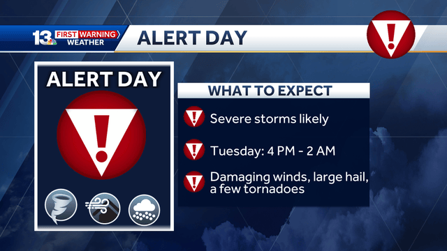
Tuesday brings a risk of severe storms. Dangerous winds, hail, and tornadoes may hit parts of Alabama. The Storm Prediction Center lists much of the state under an enhanced risk (level 3 out of 5) for severe weather. This means the storms could be strong and damaging.
The day is a First Warning Alert Day. People should watch weather updates closely and turn on alerts on their phones or radios.
Weather Radio Update
The National Weather Service in Birmingham will update its system Tuesday. This will take all NOAA weather radios offline for a short time. It is important to have other ways to get weather warnings during this update.
Storms Build in Heat and Humidity
A strong storm system will mix spring-like strong winds with summer heat and humidity. This mix creates perfect conditions for severe storms.
Northern Alabama and parts of central Alabama face the highest risk (level 3). Areas south of the I-20/59 highway have a slight risk (level 2). South-central Alabama has a marginal risk (level 1).
Storm Timing
Tuesday morning and early afternoon will be hot, humid, and mostly dry. Storms will start forming in northwest Alabama early afternoon. By evening, storms will join into a long line and move south after dark.
Here is the expected timeline for parts of Alabama:
- 4 p.m. to 10 p.m.: Northern counties like Lamar, Fayette, and Madison.
- 6 p.m. to 1 a.m.: Central counties including Tuscaloosa, Shelby, and Jefferson.
- 9 p.m. to 2 a.m.: Southern counties like Chilton, Clay, and Lee.
Keep in mind that timing and storm strength could change as the day goes on.
Tornado and Wind Dangers
The highest chance for tornadoes will be in northwest Alabama. This area has the right mix of winds and storm conditions for supercell storms, which can produce tornadoes.
The risk of a tornado within 25 miles of any point in the area is about 10%. Some strong tornadoes may happen.
Severe wind is a bigger threat across a wider area. Winds could cause trees to fall, especially since the ground is soft from recent rain. Treat all severe thunderstorm warnings like tornado warnings to stay safe.
There is a 45% chance of damaging winds within 25 miles of a point in the area marked for high wind risk.
Other Threats
Some parts of the storm line may produce large hail. It is important to watch for weather updates and be ready to take shelter if needed.
Summary
Severe weather is likely Tuesday in much of Alabama. High winds will cause the most damage, but hail and tornadoes are possible, especially in northwest counties. Stay alert, have multiple ways to get weather warnings, and be prepared to act fast if a warning is issued.


