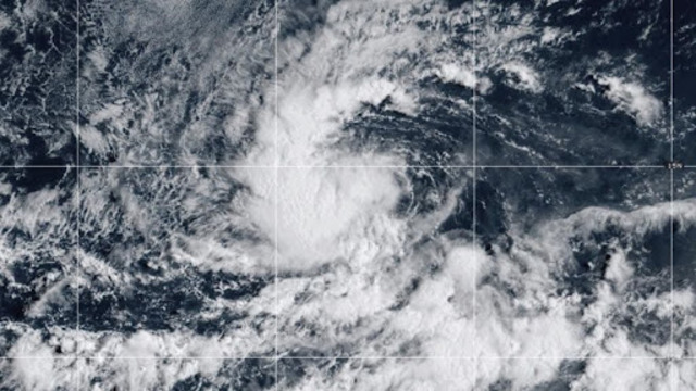
Tropical Storm Kiko developed Sunday in the eastern Pacific, over 1,000 miles from Mexico’s shoreline. Washington Times
A new tropical storm has taken shape in the eastern Pacific Ocean, more than 1,000 miles off the coast of Mexico. Named Tropical Storm Kiko, the system poses no immediate threat to land, forecasters confirmed on Sunday.
Expected to strengthen
Experts expect the storm to intensify over the next few days. “Strengthening is expected during the next couple of days, and the system is forecast to become a hurricane by Tuesday,” said the hurricane centre in its latest update.
As of Sunday morning, Kiko’s maximum sustained winds measured 40 mph, or about 65 kilometres per hour. The storm was moving at 9 mph, or roughly 15 kilometres per hour. The system sat about 1,045 miles, or 1,680 kilometres, west-southwest of Baja California’s southern tip.
Understanding storm categories
Tropical storms are defined by wind speeds between 39 mph and 73 mph. Once a storm’s sustained winds reach 74 mph, it is upgraded to a hurricane. With Kiko already near the lower end of that range, forecasters believe its path toward hurricane status could happen quickly.
No warnings issued
So far, officials have not issued any coastal watches or warnings for Mexico or any other areas. The storm’s distance from land means it remains only a system of interest to meteorologists and oceanic trackers. However, experts continue to monitor its growth closely, as weather patterns can shift unexpectedly.
Storms in the Pacific season
The Pacific hurricane season typically runs from May through November, with peak activity usually in late summer and early fall. Tropical Storm Kiko now joins a series of storms that form each year in the region, though not all reach hurricane strength or threaten communities.
For now, Kiko remains over open waters, giving forecasters time to watch its development. Mariners in the region have been advised to remain aware of updates as the system strengthens in the coming days.