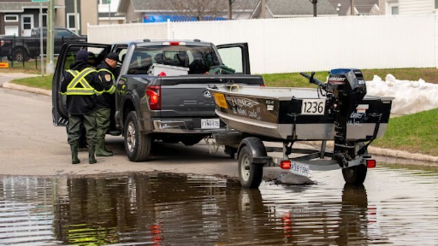
Reporter Garrett Barry shares an update on the aftermath of a severe “weather bomb” that struck Atlantic Canada, leaving behind significant damage. CTV
Canadians may want to grab their winter coats a little sooner this year. Meteorologists are warning that much of the country is entering an early cold snap, with temperatures falling well below seasonal averages.
According to meteorologist Kelsey McEwen, this November could be among the coldest in years. “We’re setting the stage for a deep freeze,” she said, explaining that a large upper trough—a dip in the jet stream—has allowed Arctic air to flow southward into Canada and the northern United States.
Jet Stream Pulls in Arctic Air
McEwen described how the jet stream, a fast-moving air current high in the atmosphere, acts as a divider between warm and cold air. “When it dips, cold air from the north gets pulled south, and that’s exactly what’s happening now,” she explained.
The result is a sharp temperature drop across most provinces. A powerful cold front on the surface is adding to the chill by pulling even more frigid air from northern Canada. “When both systems line up, especially this early in the season, the cold hits fast and hard,” McEwen said.
Subzero Temperatures Spreading East
By this weekend, much of southern and central Canada will be under the grip of winter-like weather. In Manitoba, daytime highs could dip below freezing as early as Saturday. Meanwhile, Ontario cities such as Toronto, London, and Windsor are bracing for their first snowfall of the season late Saturday or early Sunday.
“Toronto’s daytime high on Sunday will hover around 3°C, compared to an average of 9°C,” McEwen noted. “That’s about 5 to 7 degrees below seasonal across many cities.”
This cold air pattern, stretching from southern Manitoba to the Gulf of Mexico and up the U.S. east coast, is forming a vast “U-shaped” system. The air mass, which originated in the Arctic, is bringing an early taste of winter to millions of Canadians.
A Wild Week of Weather
McEwen described this week’s weather as “unique” due to several systems moving across the country at once. “We’ve had a weather bomb and a nor’easter on the Atlantic coast, a system over Ontario and Quebec, and now a Pacific front or Alberta clipper moving in,” she said.
These overlapping systems are combining to produce widespread cold and unsettled conditions. “It’s like a kickoff to winter,” McEwen added. “We’re diving in with both feet instead of easing in. This feels like a full winter preview.”
Winter’s Early Arrival
While early November often brings variable weather, this year’s quick drop in temperature stands out. Meteorologists say the shift from mild fall weather to freezing conditions could signal a long, colder-than-usual winter for many regions.
As the chill deepens, Canadians are being urged to prepare for icy roads, early snowfall, and colder nights much sooner than expected.