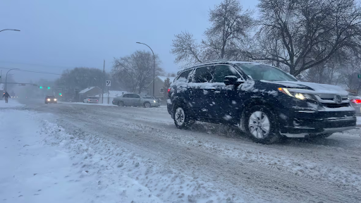
Drivers across Alberta should expect slippery, snow-covered roads on Wednesday as a major snowstorm moves through the province. CBC
A powerful winter storm will hit parts of Alberta on Wednesday. Snow and strong winds will affect many regions. Officials warned residents to prepare early. Some rural areas may see near-blizzard conditions. Travel could become dangerous very quickly.
Weather alerts now cover several parts of the province. These include snowfall, winter storm, and blowing snow warnings. Conditions may change fast throughout the day.
Edmonton Expects Up to 30 Centimetres of Snow
The Edmonton region will receive heavy snowfall. Forecasts now call for 15 to 30 centimetres by Wednesday evening. This amount increased from earlier predictions. Snow will begin Wednesday morning.
A thick band of snow will move from northwest to central Alberta. Snowfall may become heavy at times. Roads could quickly become snow-covered and slippery.
Warnings include Edmonton and nearby counties. These areas include Parkland, Sturgeon, and Leduc. Several nearby communities also fall under the alert.
Commutes Likely to Face Delays
Morning and evening commutes may face major delays. Snow will fall during peak travel times. Drivers should allow extra time.
“We are expecting snow to start Wednesday morning in the Edmonton area. That means it will be falling for your morning commute,” said Phil Darlington.
Snow will begin easing later in the day. He added, “It is set to taper off later in the day — around the time of your evening commute.”
A few more centimetres may fall Thursday and Friday morning.
Cold Temperatures to Follow
After the storm, colder air will move in. Temperatures will drop sharply. Highs could fall into the minus twenties.
“Following this round of snow temperatures are expected to drop once again. The weekend and the start of next week are set to see highs in the -20s,” Darlington said.
“So it looks like we will have a white Christmas.”
City Declares Parking Ban
The City of Edmonton announced a citywide Phase 1 parking ban. The ban starts Wednesday at 7 p.m. It covers major roads, bus routes, and business areas.
Officials said the ban will help snow crews work faster. “Due to the current accumulation and the additional snowfall we expect to receive on Wednesday, a Phase 1 parking ban is necessary for keeping roadways safe,” said Val Dacyk.
“To facilitate the clearing by our plows and graders, it is imperative that these routes remain unobstructed by parked vehicles.”
Crews will clear roads day and night. The ban may last three to five days. Vehicles parked in restricted areas may face fines or towing.
Conditions Worse Outside Edmonton
Areas outside Edmonton may see stronger winds. Snow totals of 15 to 25 centimetres are likely. Some spots could receive up to 30 centimetres.
Blizzard conditions may develop near the Saskatchewan border. Wind gusts could reach 90 kilometres per hour. Visibility may drop close to zero.
Freezing rain may fall in southern areas before turning to snow. Temperatures could drop by 15 degrees in just hours.
Major Highways at Risk
Major highways will feel the impact. Travel along Highway 2 and Highway 1 may become difficult. Blowing snow will reduce visibility.
In the mountains, conditions will worsen further. Some areas near Highway 93 may receive up to 50 centimetres of snow. Travel disruptions and closures remain possible.